http://www.boston.com/bigpicture/2008/0 ... fe_of.html
Picture 11 is the best at showing the devastation of the Bolivar Peninsula just north of Galveston. Well, it used to be the Bolivar Peninsula. It's Bolivar Island now.
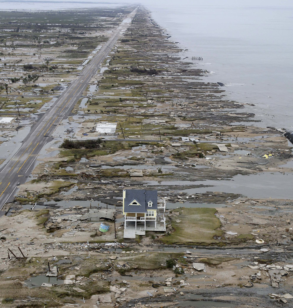


CNN had an articlelet about it. The owners were wiped out by Rita in 2005. They rebuilt, telling the contractors the new house had to be capable of withstanding a cat 5 hurricane.MarleysGh0st wrote:Whoa!
Looks like pictures of Sumatra after the 2004 tsunami.
How in the world did that one house remain standing?

Very quiet since there are no roads, bridges, or ferries to the Bolivar Peninsula right now. The county is trying to get everyone still on the Peninsula to leave. It will be interesting to see if they are ever allowed to rebuild there.Bob Juch wrote:They're going to have a quiet neighborhood until reconstruction begins.

A house to house search shouldn't take long.andrewjackson wrote: The county is trying to get everyone still on the Peninsula to leave.


It's standing but from what the paper said today, it is ruined. The inside got water in it.Rexer25 wrote:CNN had an articlelet about it. The owners were wiped out by Rita in 2005. They rebuilt, telling the contractors the new house had to be capable of withstanding a cat 5 hurricane.MarleysGh0st wrote:Whoa!
Looks like pictures of Sumatra after the 2004 tsunami.
How in the world did that one house remain standing?
Seems it'll stand a 2.

Those pictures are too typical. On just my street, three houses suffered serious tree damage. Everybody lost trees. A huge tree that fell in our neighbors yard behind our house had to be removed by a large crane.trevor_macfee wrote:Thanks for posting the link. Those are amazing pictures.